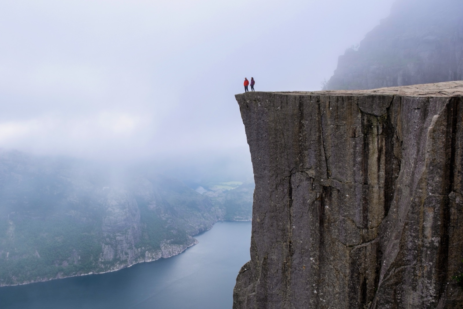
Preikestolen Weather by Month: Temperature, Rain, Daylight and the Best Time to Go
The best weather for Preikestolen comes from June to September, when the trail is generally snow-free, the days are long and the average temperature at the top is around 9°C to 10°C in high summer. May and September are the sweet spots if you want decent conditions with fewer people. The trail is open all year, but from November to March you are hiking in short daylight, often on snow and ice, and the weather on the plateau is colder, windier and wetter than anything you see in Stavanger. Whatever the month, rain is normal here: even the driest stretch of the year has rain on more than half the days.
This guide puts the numbers side by side: the climate normals for Stavanger, the measurements from the weather station closest to Preikestolen, and the month-by-month table published by the Preikestolen Foundation, which runs the trailhead. It then turns them into practical advice on when to go, when to start, and what to do when the forecast looks poor. For the hike itself, see the Preikestolen hike guide; for snow and ice, see Preikestolen in winter.
Preikestolen weather at a glance
Three sources are worth knowing. MET, the Norwegian Meteorological Institute, publishes climate normals for Stavanger for 1991-2020. Yr, the weather service run by MET and NRK, shows statistics for Preikestolen from the Liarvatn measuring station, 8.1 km from the plateau. And the Preikestolen Foundation’s visitor site, Preikestolen 365, publishes a table of the typical temperature at the top, rainy days and sunshine for each month.
| Month | Stavanger low to high | Stavanger rain | Average at the top | Rainy days | Sunshine a day |
|---|---|---|---|---|---|
| January | 1°C to 5°C | 121 mm | -4°C | 22 | 1 hour |
| February | 0°C to 5°C | 90 mm | -4°C | 20 | 3 hours |
| March | 2°C to 7°C | 103 mm | -1°C | 18 | 5 hours |
| April | 4°C to 10°C | 69 mm | 1°C | 17 | 6 hours |
| May | 7°C to 14°C | 71 mm | 5°C | 17 | 7 hours |
| June | 10°C to 16°C | 84 mm | 9°C | 17 | 8 hours |
| July | 12°C to 18°C | 108 mm | 10°C | 18 | 7 hours |
| August | 12°C to 18°C | 136 mm | 10°C | 21 | 6 hours |
| September | 10°C to 15°C | 168 mm | 7°C | 24 | 4 hours |
| October | 7°C to 12°C | 165 mm | 4°C | 24 | 3 hours |
| November | 4°C to 8°C | 149 mm | 0°C | 26 | 1 hour |
| December | 2°C to 6°C | 132 mm | -3°C | 24 | 1 hour |
Two things stand out. The plateau is several degrees colder than the city in every month, and the summer at the top is cool rather than warm: in July and August the foundation’s table gives an average of 10°C. Over a whole year Stavanger averages 8.5°C and 1,396 mm of precipitation, with about 1,500 hours of sunshine, 50 frost days and 20 snow days.
Why the top is colder than Stavanger
Stavanger sits by the sea. The trail starts inland at the Preikestolen Parking car park and climbs to a plateau 604 metres above the Lysefjord, with a total elevation gain of 500 metres along the way. Height, exposure and the fjord’s own winds all count against you.
The foundation spells it out in its off-season advice: it is colder at the top than at the trailhead, often windier and rainier, and visibility can be worse further up the trail. It adds that mountain weather in Norway is often very different from the weather in the city. Visit Norway’s listing for the hike makes the same point from a summer angle: there is often a chilly breeze at the top, even in summer.
In practice that means a sunny morning in Stavanger tells you little about the plateau. A light shower in town can be driving rain and low cloud on the top, and a calm harbour can mean a cold, gusty edge. Check a mountain forecast for Preikestolen itself, not the city.
Spring: April and May
April and May are when the trail wakes up. The foundation describes green starting to mix with the snow and creeks and waterfalls swelling with meltwater. Visitor numbers are still quite low, especially on weekdays, and May is singled out for its fresh spring colours.
- Temperatures: the table gives 1°C at the top in April and 5°C in May. Stavanger’s normals are 4°C to 10°C in April and 7°C to 14°C in May.
- Rain: spring is the driest part of the year in the city, with 69 mm in April and 71 mm in May. The table still counts 17 rainy days in each month.
- Daylight: you get around 6 to 7 hours of sunshine a day on average, and the latest recommended start moves from 3:00 pm in April to 4:30 pm in May.
- The catch: early in April there can still be snow and ice on parts of the trail, and it can come back in a cold spell. Ask the trailhead staff, who are there all year.
May is a strong choice if you want long days without the summer crowds. The Lysefjord cruises run then too, and in May the summer cruise-and-hike season starts.
Summer: June to August
June, July and August are the peak season. The foundation describes very long days and often nice weather, and this is when the trail is generally snow-free and suitable for most hikers.
- Temperatures: around 9°C to 10°C on average at the top, and 10°C to 18°C in Stavanger. Warm days do happen: the Liarvatn station measured 27.1°C on 15 July 2026.
- Rain: summer is not dry. Stavanger’s normals rise from 84 mm in June to 136 mm in August, and the foundation’s table gives 17 to 21 rainy days a month.
- Daylight: in good weather it can stay light until midnight, but it still gets dark at some point. The latest recommended start is 5:30 pm in June and July and 4:30 pm in August.
- Crowds: this is the busy season. Peak summer days see up to 7,000 hikers, the car parks can fill, and there are queues at the most popular photo spots.
If you go in summer, the weather is rarely the problem; timing is. The foundation recommends starting before 08:00 or in the late afternoon to avoid the crowd peak, which forms between 08:00 and 11:00. Weekdays are quieter than weekends. Because of the numbers on the trail, it also advises against bringing dogs in summer.
Autumn: September and October
September and October are popular for autumn colours and fewer visitors. The foundation calls autumn the season of flame-coloured foliage, and by September visitor numbers have dropped significantly.
- Temperatures: 7°C at the top in September and 4°C in October, by the foundation’s table.
- Rain: this is the wettest part of the year. Stavanger’s normals are 168 mm in September and 165 mm in October, and both months have 24 rainy days in the table.
- Daylight: shrinking fast. The latest recommended start falls from 2:30 pm in September to 1:00 pm in October.
- The bonus: quieter trails, and in clear spells the low autumn light on the fjord.
Autumn rain can be heavy. In September 2026 the Liarvatn station recorded 429.0 mm, its wettest month of the period, and on 5 October 2026 a single day brought 110.8 mm. On days like that, wet rock and streams on the path become the main hazard. If a front is coming through, move the hike to the next dry window rather than pushing through it.
Winter: November to March
From November to January Preikestolen is usually very quiet, and February and March can bring spectacular scenery with snow and ice. Most winter days see fewer than 100 hikers. It is also the season that asks the most of you.
- Temperatures: the table gives 0°C at the top in November, -3°C in December and -4°C in January and February. Cold snaps go well below that: Liarvatn measured -15.9°C on 8 January 2026.
- Rain and snow: November is the wettest month in the table, with 26 rainy days. Stavanger’s November normal is 149 mm.
- Daylight: the shortest winter days last about 6.5 hours, and the table gives only 1 hour of sunshine a day from November to January.
- Trail: snow and ice often make the trail slippery, and at times it may not be visible at all.
Winter hiking is possible, but it needs proper winter equipment, experience and careful planning. Fjord Norway and the foundation both recommend a guide in winter, especially if you have not hiked on snow and ice before. Our winter guide covers spikes, guided options and transport when the express buses are not running.
Rain: the wettest months
Rain is the one constant at Preikestolen. Even the best months in the foundation’s table have 17 rainy days, and the busiest summer month, August, has 21. The pattern is clear in the Stavanger normals:
- Driest: April (69 mm) and May (71 mm), then June (84 mm) and February (90 mm).
- Wettest: September (168 mm), October (165 mm) and November (149 mm).
The hills near the fjord get far more than the city. Yr’s normals for the Liarvatn station, near Preikestolen, give 284 mm for October and 293 mm for December, against 165 mm and 132 mm in Stavanger. Even July’s normal there is 172 mm. Over the 13 months to October 2026, the station logged precipitation on 196 days.
What does that mean on the trail? Rain rarely stops people hiking in summer, but it changes the walk. Rock slabs get slippery, the wettest sections of the path turn muddy despite the bridges, and the view from the top can disappear into cloud. Good boots and a proper waterproof jacket matter more than a perfect forecast.
Wind, fog and visibility
The plateau is about 25 x 25 metres, flat, and unfenced. Wind is the weather that matters most up there. The Liarvatn station’s strongest gust in the 13 months to October 2026 was 26.1 m/s, on 5 April, and the foundation lists wind alongside rain, snow and ice as conditions that can affect safety.
Low cloud is common, and it can roll in while you are on the way up. When it does, you lose the view and some of your sense of where the edge is. Keep well back from the drop in poor visibility, stay on the marked trail, and do not rely on following other people’s footsteps. If conditions start to look unsafe, the foundation’s advice is simple: turn around.
Daylight and the latest start time
Daylight sets the shape of the day more than temperature does. The foundation publishes the latest time you should start the hike in each month, and asks hikers to respect it.
| Month | Don’t start the hike after |
|---|---|
| January | 11:00 am |
| February | 12:00 (midday) |
| March | 1:00 pm |
| April | 3:00 pm |
| May | 4:30 pm |
| June | 5:30 pm |
| July | 5:30 pm |
| August | 4:30 pm |
| September | 2:30 pm |
| October | 1:00 pm |
| November | 12:00 (midday) |
| December | 11:00 am |
For a sense of scale: on 21 December 2026 the sun rises in Stavanger at 09:29 and sets at 15:40, giving 6 hours 11 minutes of daylight. The June solstice day is 12 hours 18 minutes longer. From September through March, start early and plan to be back before dark, and always bring a torch in case of unplanned delays.
Preikestolen lies about 1,500 km south of the Arctic Circle, so there is no midnight sun and no polar night. The flip side is that the chance of seeing the northern lights from the plateau is close to zero.
Crowds by season
Weather and crowds pull in opposite directions. The best weather brings the most people.
- June to August: the peak. In the summer of 2022, 348,000 people hiked to Preikestolen. Saturday and Sunday are the busiest days.
- May and September: good conditions with noticeably fewer people, especially on weekdays.
- October to May: visitor numbers are usually very low.
- November to January: usually very quiet, with a more solitary experience.
The foundation publishes an hourly visitor forecast showing how busy the trail is expected to be over the next 36 hours, which is the most useful tool for picking a start time in summer.
So when is the best time to go?
It depends on what you want from the day.
- For the best chance of good weather and an easy trail: late June to August. Start early or late to dodge the crowd peak.
- For good weather with fewer people: May and September. Expect cooler air at the top and plan for rain either way.
- For autumn colour: September and early October, accepting that these are wet months.
- For snow scenery and solitude: February and March, ideally with a guide.
- The month to think hardest about: November, which has the most rainy days in the table, short days and an often icy trail.
If you have a choice of days in the area, keep one spare. The foundation suggests planning an extra day if you travel from far away, so that one poor forecast does not cost you the hike. If the weather lets you down completely, the Lysefjord cruise from Stavanger runs all year regardless of the weather, though only from Thursday to Sunday in winter, and shows Preikestolen from the water below. See the Lysefjord cruise guide for times.
Reading the forecast before you go
Check a local mountain forecast for Preikestolen before you set off, not the forecast for Stavanger. Yr has a forecast and a statistics page for Preikestolen itself. Then use the foundation’s own advice to read it:
- If very poor weather is forecast, cancel or reschedule your hike.
- If the forecast is borderline, allow extra time so you finish before dark.
- Expect change. Forecasts can be wrong or change sharply and quickly, especially outside peak season.
- Ask at the trailhead. The parking area is staffed all year, from 07:00 to 18:00 in summer and 09:00 to 14:00 in winter. If the staff say not to hike, respect that.
- Look at the webcam. Preikestolen BaseCamp has a webcam showing conditions at the trailhead in real time.
Do not be fooled by perfect conditions when you start. The weather changes quickly in the Lysefjord, and BaseCamp’s advice is to be ready for sun, wind and rain on the same trip.
What the weather means for what you pack
You walk for about 4 hours round trip, with no water refills along the trail and toilets only at the car park. Pack for the plateau, not the car park.
- All year: sturdy hiking boots, a wind- and waterproof outer layer, a spare warm layer, food, and water.
- Summer extras: something warm for the breeze at the top, sun protection, and a seat pad for the lunch break.
- Shoulder seasons: hat and gloves, an extra layer and a torch.
- Winter: wool base layers, hat, scarf and mittens, warm boots and shoe spikes or ice cleats when there is snow and ice. BaseCamp rents boots, spikes and warm clothing all year.
The hike guide has a fuller packing list. If you would rather leave the timing and weather calls to someone else, a guided hike is worth considering; see the tours page.
Frequently asked questions
What is the best month to visit Preikestolen? For weather and an easy trail, July and August, though they are also the busiest. June is close behind, and May and September give the best balance of conditions and crowds.
How cold is it at the top of Preikestolen? The foundation’s table gives an average of about 9°C to 10°C at the top from June to August, 0°C in November and -4°C in January and February. Wind makes it feel colder.
Does it rain a lot at Preikestolen? Yes. Even the best months in the foundation’s table have 17 rainy days, and September to November are the wettest. Bring waterproofs whenever you go.
Can you hike Preikestolen in bad weather? In light rain, many people do. In strong wind, heavy rain, fog or icy conditions, the advice is to reschedule, and to turn back if conditions get worse on the way.
When does it get dark at Preikestolen? It varies hugely. In late June it can stay light until around midnight; in December the sun sets in Stavanger before 16:00. Use the foundation’s latest-start table above.
Is there snow at Preikestolen in winter? Often. In January, February and March Preikestolen and the Lysefjord are often blanketed in snow and ice, and the trail can be slippery from October to April.